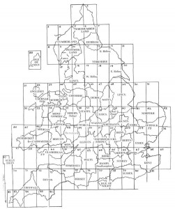
A Genealogical Atlas of England and Wales
compiled from original maps by David E. Gardner, Derik Harland, and Frank Smith. Published by Stevenson’s Genealogy Center. These web pages are provided free for your personal use, but are not to be copied for sale or distribution. You may freely link to this page for reference. The most valuable part of these maps is the index of over 11,000 towns and cities. Use the index to find the city and the map coordinates then link back to the map to find it faster. These are high resolution PDF maps so the detail is clear at high magnification (some maps are almost 2 megabytes) so be patient for them to open in your browser. If you need Adobe Acrobat Reader, click here to download. If you find mistakes or have questions or suggestions, please feel free to contact us.
Terms of use and Copyright
These map pages are for your FREE use and are downloadable for use in your own research. No commercial reproduction of any kind is permitted without prior written permission. Copyright of the images remain with us. They are for your personal use and research. PLEASE respect the copyright and DO NOT use for any purpose other than your own personal research. Thank You!


You could send with my today’s order.
Sorry, we don’t have these pages separately, just in the book. But you can print it out from the image online.
How do I get access to this? It would be extremely helpful mapping the movements of my ancestors.
Look under the Free tab, the maps are great and the index is super helpful.